
De excursión
¿Cuáles son las mejores rutas de senderismo con vistas panorámicas cerca de Seattle?
Just a short drive from Seattle, you can find hikes with views of waterfalls, snow-capped volcanoes, and old-growth evergreen forests.
Spring and summer offer sunny skies and meadows dotted with wildflowers, while autumn brings bright foliage throughout the region. Read on to find some of the best hikes with views not far from Seattle.
Beginner-Friendly Hikes South of Seattle
Don't want to venture far? Check out these easy, beginner-friendly hikes in Seattle Southside, the area around Sea-Tac Airport. If you're staying in or near Seattle, all of these hikes are under an hour's drive. They're just rugged enough to make you feel like you got out into nature, but close enough that you can head out at a leisurely place and be back at your home or hotel with plenty of time to spare.
Visiting from out of town? Seattle Southside is the ideal home base for exploring the Northwest. Choose from one of 60 hotels near Sea-Tac Airport.

The Des Moines Creek Trail
Difficulty: Easy
Length: 4 miles
The Des Moines Creek Trail is a paved, tree-lined path that runs for about 2 miles one way, from a trailhead in SeaTac to the Puget Sound shoreline. It's accessible from either end, but you'll have different experiences depending on which you choose. Either way, you'll pass a babbling creek where salmon swim in the fall, plenty of leafy trees, and occasional benches for resting. It's a popular family-friendly activity and great for bird-watching. If you follow it to the end and turn around, it makes for a nice 4-mile out-and-back hike.
North entrance: You can either park in a small parking lot or reach the trail via public transit (it's a short walk from the Angle Lake Link light rail station). The walk begins fairly flat before sloping downhill, then taking a sharp right about halfway. After 2 miles, you'll emerge in beautiful Des Moines Beach Park, where you can extend your hike onto the rocky shoreline or the long pier.
South entrance: Alternatively, you can begin at Des Moines Beach Park, where there is a parking lot. Walk back through the meadow to enter the trail from the south. The trail is fairly flat for the first 15 minutes or so, but does transition into a pretty steep (though smooth) uphill walk.
Is the Des Moines Creek Trail kid-friendly? Yes! Little kids or parents with strollers can handle the first part of the walk well, since it's smooth and well-maintained. If you start at the beach, just walk into the trail until it starts to slope upward, then turn around and head back. Near the north entrance is Des Moines Creek Trailhead Park, opened in 2026, which has accessible playground features and picnic shelters.

The South Rim and North Rim Trails at Salwater State Park
Difficulty: Easy
Length: 2 miles
Saltwater State Park in Des Moines offers more hiking near the Puget Sound shoreline. If you want to maximize waterfront views, follow the easy trail along the beach from the main parking area. If you want more of a hike in the woods, follow the South Rim and North Rim trails into the forest, where there are about two miles of trails to explore and easy-to-moderate terrain that includes several climbs and descents. You'll walk along McSorley Creek and across fun wooden footbridges, possibly even spotting salmon depending on the time of year. Along the way, you'll see interesting root structures along the hillside and plenty of interesting plants, flowers, berries, fungi, and birds (including owls!).
From the main parking lot: Head uphill beneath Marine View Drive, following McSorley Creek. Stay on the main trail (ignoring the small trail on your right), then descend into the campground between sites 23 and 25. Pick up the trail across the way between sites 22 and 24, climbing back into the woods before a switchback leads you roughly west toward the shoreline. This North Rim Trail section ends at a small bluff-top parking lot. Walk downhill along the road, watching for vehicles, to return to your starting point. Reward yourself with some beach time afterward.
Don't forget: A Discover Pass is required to park. They can be purchased online in advance.
Are the trails at Saltwater State Park kid-friendly? The trail along the beach is very family-friendly, even for young children. The wooded trails include inclines and downhill stretches that may tire out younger hikers, but if it proves too challenging, you can always retrace your steps before heading to the beach. The trails are also not stroller-friendly, so bring a carrier and keep children close during the final walk along the road.
Westside Trail and North Loop at North SeaTac Park
Difficulty: Easy
Length: 1.5 miles
Just minutes from Sea-Tac Airport, you'll find North SeaTac Park, a large, multi-use park with a path around its perimeter that you can make into a roughly 1.5-mile walk. The Westside Trail and North Loop offer an easy, mostly paved route that passes through the wooded northern portion of the park.
Access the trail: If you start at the parking lot off South 128th Street, you can connect to the Westside Trail, following the route around the park’s north end. Paths through the center offer options to shorten your walk, while connecting trails lead to the Highline SeaTac Botanical Garden for a scenic detour. Keep a trail map handy: The terrain is easy, but the many forks and intersecting paths can make navigation tricky.
Is North SeaTac Park kid-friendly? Yes! The path is a great, stroller-friendly option for families, especially if you stick to the paved parts. You can adjust the outing to suit little legs by choosing a shorter route through the park. There are also lots of fun things to do within the park like an RC Track (for remote-controlled cars), a playground, playfields, and disc golf.
Popular Hikes East of Seattle
East of the Seattle area lies the gorgeous Cascade Mountain range and the surrounding foothills. You only have to drive about half an hour to reach popular hikes with great views, and if you go further, you'll find there are endless trails to explore. These are just a few we recommend.
Note: Most of these hikes would be too hard for young kids, but if kids are older (typically 8 and up) and confident walking up steep inclines, they may be able to handle the moderate options. Of the below, the most popular hike for families is Wallace Falls.
Coal Creek Trail at Cougar Mountain
Difficulty: Moderate
Length: 6 miles
Distance from Seattle Southside: 13.5 miles
About a 30-minute drive east of Seattle Southside, Cougar Mountain Park offers more than 35 well-maintained trails that wind through forests, wetlands, cliffs, and caves. Within this beautiful area, Coal Creek Trail is a popular, forested hike with historical artifacts, waterfalls, and wooden bridges.
Follow the trail down a deep ravine, past old mine shafts, rail ties, and other coal-mining remnants from the late 1800s. You won't gain a ton of elevation, so it's a good choice if you don't want to push yourself too hard.
Grand Ridge Park Trail
Difficulty: Hard
Length: 7 miles of trails
Distance from Seattle Southside: 25 miles
Grand Ridge Park, just east of Issaquah, features 7 miles of scenic trails that wind through forests of western red cedar. This 1,300-acre wilderness area is located just north of Issaquah and Lake Sammamish, and is open to hikers, mountain bikers, and equestrians. A highlight of the trail is a beautiful 40-foot-long, hand-built bridge that spans Canyon Creek.
Monte Si
Difficulty: Hard
Length: 7.6 miles
Distance from Seattle Southside: 40 miles
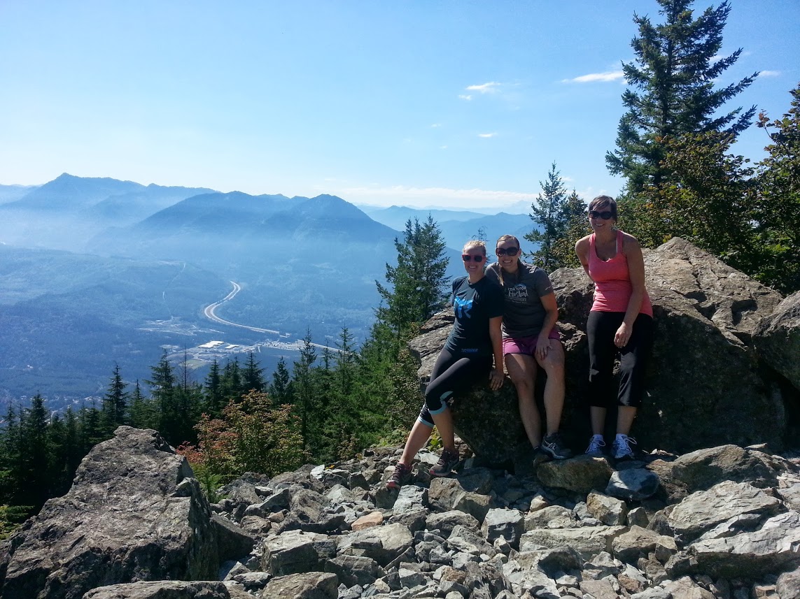
El monte Si es una ruta de senderismo exigente y muy popular situada en el Área de Conservación de Recursos Naturales del Monte Si, cerca de North Bend, en el estado de Washington. El sendero tiene una longitud aproximada de 13 km ida y vuelta, con un desnivel de unos 960 metros. La ruta comienza en un denso bosque de coníferas y asciende de forma constante a través de zigzags bien mantenidos. A unos 5,6 km, los excursionistas son recompensados con unas vistas panorámicas desde una ladera rocosa, que incluyen vistas del monte Rainier en días despejados. La última sección llega a una meseta situada debajo de la cima; los excursionistas experimentados pueden subir al «Haystack» para disfrutar de unas vistas panorámicas.
You can see both Mt. Rainier and Mt. Saint Helens from atop Mt. Si!
Sendero Granite Mountain
Difficulty: Hard
Length: 8.2 miles
Distance from Seattle Southside: 52 miles
Ready for something a bit more wild and challenging, venture into the gorgeous Cascade Mountains. A great introduction to Northwest hiking is the Granite Mountain Trail, about an hour east of Seattle. Snoqualmie Pass corridor's most heavily traveled summit path is admittedly a calf-burner, but the 360-degree views of Mt. Rainier and Snoqualmie Pass make the 3,800-foot climb well worth it.
Visitor tip: Pull over on your way there or back to admire Snoqualmie Falls, one of the most popular sights in the state. You can park right at this massive waterfall, use the restroom, check out the gift shop, and admire the falls from the well-maintained lookout spot.
Sendero del lago Pratt
Difficulty: Hard
Length: 12 miles
Distance from Seattle Southside: 52 miles
Pratt Lake near Snoqualmie Pass is ideal for this transitional season, and the Pratt Lake Trail is great for accessing fishing, scrambling, and other hiking trails. You'll climb over Evergreen-lined switchbacks to a high ridgeline. Beyond the Olallie Lake junction, the trail crosses open, rocky terrain before descending into the basin cradling Pratt Lake. Clear mountain water and granite outcrops make the shoreline a rewarding spot for a picnic or rest, but save some energy for the return trip. You’ll need it to climb back to the ridge before descending to the trailhead.
Wallace Falls via Woody Trail
Difficulty: Moderate
Length: 5.2 miles
Distance from Seattle Southside: 55 miles
Located in the Cascade Mountains, about 1.5 hours north and east of Seattle Southside, Wallace Falls features a breathtaking series of nine waterfalls. Though the full, 9-mile loop is challenging, you can make this into an easier excursion. The Woody Trail follows the Wallace River through lush forest, with waterfall viewpoints providing rewarding places to pause or turn around.
From the parking lot, follow the well-marked trail east. You’ll climb away from the river on a briefly steep stretch before reaching the Lower Falls area at just under two miles. Wallace Falls is a series of nine cascades, with the trail leading to viewpoints of the Lower, Middle, and Upper Falls as it gains elevation.
Is Wallace Falls kid-friendly? This is a popular hike for families, especially if you stop at Middle Falls before hitting the steeper climb to Upper Falls. Much of the elevation gain comes between these two viewpoints, so there’s no need to tackle the full route to enjoy the scenery.
También le puede interesar...

Excursión guiada de un día al monte Rainier desde Seattle
Una visita al pico más alto de Washington es una experiencia inolvidable.

10 de los mejores senderos, parques y playas de la zona sur de Seattle
¡Descubre la naturaleza en el sur de Seattle!

Ciclismo urbano: Lo mejor de la zona sur de Seattle
Pisa el pedal... ¡y pedalea! La bicicleta es una forma más ecológica y saludable de moverse por la ciudad.

Dónde hacer ejercicio en la zona sur de Seattle
Correr, montar en bicicleta, saltar, estirarse... Hay infinitas formas de hacer ejercicio en Seattle Southside.